
| Ilam इलाम | |
|---|---|
| — District — | |
 | |
| Country | |
| Region | Eastern (Purwanchal) |
| Zone | Mechi |
| Area | |
| - Total | 1,703 km2 (657.5 sq mi) |
| Population (2001) | |
| - Total | 282,806 |
| - Density | 166.1/km2 (430.1/sq mi) |
| Time zone | NPT (UTC+5:45) |
| Main language(s) | Limbu, Nepali |
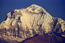
Ilam district, इलाम, a part of Mechi Zone, is one of the seventy-five districts of Nepal, a landlocked country of South Asia. The district, with Ilam as its district headquarters, covers an area of 1,703 km² and has a population (2001) of 282,806. It is situated at a distance of about 600 km from Kathmandu. The highest point is Sandakpur with lies on an elevation of 3000m. Ilam also attracts many researchers who come here to research rare birds and the Red Panda. Ilam stretches from Terai belt to the upper hilly belt of this Himalayan nation.
The name Ilam is derived from a Limbu language meaning "Ii" means Twisted and "Lam" means Road. Ilam was one of the ten self ruling states of Limbuwan before the unification of Nepal, its ruler King Hangshu Phuba Lingdom of Lingdom dynasty was ruling Ilam as a confederate state of Limbuwan until 1813 AD. The treaty between other Limbuwan states with the King of Gorkha (Gorkha-Limbuwan Treaty of 1774 AD) and the conflict of Gorkha and Sikkim led to the unification of Ilam with Gorkha. Ilam was the last of ten Kingdoms of Limbuwan to join the union of Nepal. King of Gorkha gave ruler of Ilam a full autonomy to rule and the right of Kipat. Ilam was independent Limbu Kingdom until 1813 CE/1869 BS.
Ilam is a today one of the most developed places in Nepal. Its tea ILAM TEA is very famous and exported to many parts of Europe. The main source of income in this district is tea, cardamom, milk, ginger and potato.
This place also has a religious importance. The devi temples has a great importance attached with it and lots of people come here just for pilgrimage.
The major attraction of Ilam is the 9-cornered Mai Pokhari lake. Also Known as the abode of the goddess lots of tourists as well as Nepalese people come to visit this lake. Mai river and its four tributaries also emerge in Ilam district. The famous Mane Bhanjyang ( Mane pass ) connects Ilam with Darjeeling district of West Bengal India.
Ilam was much in the news in the past during the Maoist insurgency, from here the Maoist launched massive attacks frequently.
Tourist going to Ilam can expect to pay around 1000 rupees a week for accommodation and food.
Towns and villages

Amchok, Bajho, Barbote, Chamaita, Chisapani, Chulachuli, Danabari, Dhuseni, Ebhang, Ektappa, Ebhang*, Erautar, Gajurmukhi, Ghuseni*, Godak, Gorkhe, Ilam, Jamuna, Jirmale, Jitpur, Jogmai, Kanyam, Kolbung, Laxmipur, Lumde, Mabu, Mahamai, Maimajhuwa, Maipokhari, Mangalbare, Namsaling, Naya Bazar, Panchakanya, Pashupatinagar, Phakphok, Fikkal Bazar, Phuyatappa, Puwamajhuwa, Pyang, Sakfara, Sakhejung, Samalpung, Sangrumba, Shanti Danda, Shantipur, Shree Antu, Siddhithumka, Soyak, Soyang, Sri Antu*, Sulubung, Sumbek


No comments:
Post a Comment